1408m - 19.8 km (Ponte Gardena/Waidbruck); 1489m - 20 km (Ponte Gardena via Bula/Pufels)
1417m - 26.4 km (Chiusa/Klausen via Bulla/Pufels); 724m - 9.9 km (Urtijëi/St. Ulrich via Bula/Pufels)
1157m - 21.3 km (Prosels/Presule bivio); 824m - 13.8 km (Kastelruth/Castelrotto)
562m - 9.4 km (S. Crestina); 625m - 10.7 km (S. Crestina via Monte Pana)
1408m - 17.5 km (Ponte Gardena/Waidbruck via direct road)
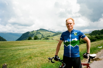
This is one of the most visited tourist places in the Dolomites. It is also one of the largest high pastures in the Dolomites between some of the nicest mountains here. This is not usually regarded as a pass, but this is a de facto pass road that takes one from one valley (Ratzestal?) that goes up from the big Isarco valley and over to S. Crestina/St. Christina/S. Cristina in Gherdëina/Gröden/Val Gardena via Val de Jënder/Jëndertal/Valle Jënder (Iënder on most maps).
One could climb from either Waidbruck/Ponte Gardena/Pruca (465m) or from Prato all’Isarco/Blumau (325m) outside Bolzano/Bozen/Bulsan in the Isarco/Eisack/Isarch valley. Both these climbs are long and hard. The climb from S. Crestina (1311m or 1391m) in Gherdëina is partly on gravel road through the forest. I am not sure if the road via Mont de Pana/Monte Pana is better or not, but there are two alternative roads out of S. Crestina up to Saltria and the pass. These roads are mostly only hard due to being gravel if using a road bike – I tried the Streda Jënder directly down from Saltria and could ride it all with care (it was hard going) apart from a steep ramp going up on the way down.
If coming from Pas de Pinëi/Panider Sattel/Passo di Pinei (1442m) one starts the climb in Kastelruth/Castelrotto/Ciastel (1049m) and if one comes from Nigerpass/Passo Nigra (1685m) one can start the climb below Prosels/Presule (716m) on the main road from Prato all’Isarco.
The hardest climb (apart from a new possibility below) up here starts by the old Kastelruth railway station (429m). This road was bad in year 2000 when I climbed up there on my first time to a pass above 2000 metres (Passo Sella), so it may still be bad until you reach the circle road above that takes you to the road from Ponte Gardena to Kastelruth.
One could now also climb to this pass via Bula/Pufels/Bulla from Urtijëi/St. Ulrich/Ortisei (1231m) on a very steep asphalt road up through the Pufler schlucht – the steepest variant starts in Runcadic/Runggaditsch/Roncadizza (1141m) and if you cross the Pas de Pinëi road and take the road straight ahead (closed, but passable, when I took it in 2016 apart from the final 100m to meet the other road where I had to walk, but they will likely fix this section again) you will get a terribly steep climb with sections over 20% on a somewhat bad road (242m up in 1.6 km for 15.3% on average). To avoid this steep section, you take off the road over Pas de Pinëi to Bula and then keep climbing (there is a short descent on this road via Pufels/Bula from 1552m to 1471m). This variant would be natural if climbing from Chiusa/Klausen/Tlüses (537m) and from Waidbruck/Ponte Gardena.