Sign 2503m
1301m - 18.4 km (Bormio)
1264m - 17.6 km (Premadio)
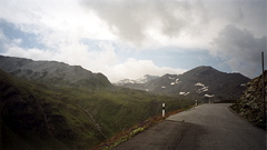
This is the highest paved pass in Switzerland. The road starts in the remote Swiss corner of Sta. Maria im Müstair (1375m) and it serves as a short-cut to Bormio in Italy, but as there is no big reason for needing to go to Bormio for the Swiss people, it is very little used and only recently got fully asphalted. It is steep up from Sta. Maria in a seemingly endless series of hairpins in the woods. Thereafter you reach the upper valley with the short and flatter unpaved (but good) stretch, before the final steep ascent to the pass starts. Far up to your left you will soon see the Passo dello Stelvio/Stilfser Joch/Pass da Stielva (2758m). The Umbrail pass is also the border between Switzerland and Italy.
From Bormio (1200m) it is the same steep road that goes to the Stelvio pass, but you will miss the last 10 or so hairpins up to the Stelvio pass by turning off to Switzerland at the junction. If you come down from Passo di Foscagno/Pass da Fus-chagn (2289m) or Passo Torre di Fraele/La Bocchetta (1938m), the shortest way is to descend through Ponte di Premadio (1237m) and climb a small road up to the normal Bormio-Stelvio road.
[CH-GR-2501]