1551m - 30.54 km - 5.1% (Bramois) (1775m - 35.23 km to Ferpècle)
792m - 22.8 km (Vex); 617m - 12.3 km (Praz-Jean)
[CH-VS-1750]
|
Height | Climbing height - length |
| 1731m | 1272m - 28.51 km - 4.3% (Sion) (1497m - 33.21 km to Ferpècle) 1551m - 30.54 km - 5.1% (Bramois) (1775m - 35.23 km to Ferpècle) 792m - 22.8 km (Vex); 617m - 12.3 km (Praz-Jean) |
|
| Difficulty | Beauty | |
| 3 (5) | 4-5 (5) | |
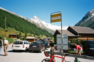
| How to get there | The climb starts in the Valais/Wallis valley at Sion (499m) and you go up the lovely Val d’Hérens via Vex (939m) and Evolène to Les Haudères (1452m) and then turn left up toward Ferpècle (1896m at the little dam). At the crossroad for La Sage you turn right and soon reach Col de la Forclaz. It is a bit steep from the bridge before Praz Jean (998m) to just before Evolène (1397m) and the last bit from Les Haudères. It can be quite warm on the first part from Sion to Vex. You could alternatively start the climb a bit east from Sion in Bramois (499m) and take the route de Nax (I am showing a steeper alternative on the early part). This brings you to Suen/St.-Martin (1430m), from where there is a descent to Praz-Jean (1111m), which is where you join the other road up via Evolène. | |
| Other comments | It is very nice beyond Vex and at Euseigne you will find some nice earth pyramids. Evolène is a good place to stop for water (water tap in the centre), but there are also cafés and shops. The views from this pass are very great with Dent Blanche to the left! There are some alternative climbs starting in Vex that also may be as nice or nicer: Thyon (2096m), Arolla (2100m) and Barrage de la Grande Dixence (2141m or 2365m (the last gravel stretch is not allowed for cyclists)). It is probably nice to continue up to Ferpècle, but did not do that on my visit (there is first a little descent before thge final climb to the end of the valley). [CH-VS-1750] |
|
| Map |
||