homeCol de la Molière
Col de la Molière Height Climbing height - length
1633m 1430m - 33.6 km (Sassenage)
629m - 15.6 km (Lans-en-Vercors)
592m - 16.3 km (Autrans)
Difficulty Beauty
2-3 (5); 3 (5) (Sassenage) 4 (5)
How to get there

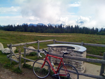
This is a very long climb from Sassenage (203m) west of Grenoble via Lans-en-Vercors (1006m) (which is a high plain, that also serves as a pass). It is very nice on the climb up from Lans to Col de la Croix Perrin (1218m) before you enter the woods. At this pass you can follow a long forestry road, which is not all paved, but most of it is (might change in way or another). This road is somewhat bad here and there but not steep and clearly possible with a road bike. When you finally reach the last turn-off up the ridge to the pass it becomes quite steep on a poor road, but asphalted.

From Autrans (1041m) you will do best in going up via Pas du Mortier (tunnel) (1392m), but not go through the closed tunnel, but instead up to the left on the same forestry road that goes to Col de la Croix Perrin, but this road is much better from here to the turn-off for the pass.

Other comments There are nice views from the pass in good weather. You should combine this pass with a visit to the famous Mortier tunnel. The road was apparently built for the Olympic games in Grenoble in 1968, but there was a massive landslide in 1992 which makes the road impassable on the northern side. You can walk through the landslide on a path that is dangerous in the critical middle section for a couple of metres, but I do not recommend it – if you fall there, you will likely not stop falling for a few hundred metres down the slope … ). Apparently repair would be too costly, so there are no plans on rebuilding the road (and looking at the site, you will wonder why they tried to build a road there in the first place). There are however lovely views on this side of the dark tunnel and going through it is not problematic!
[FR-38-1632]
Map