Sign 1607m
1100m - 15 km (Champerioux); 442m - 6 km (bivio Tzecore/Joux)
574m - 6.4 km (Challand-St.-Anselme); 791m - 9.9 km (Challand-St.-Victor)
1219m - 16.1 km (Verrès)
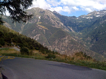
The longest climb to Col Tzecore starts from Verrès (389m) at the start of the Val d’Ayas in Aosta. One could start in Challand-St.-Anselme (1034m) if coming down from Colle di/Col de Joux (1640m) or La Croix (1700m). One could be starting from Challand-St.-Victor (Châtaignère) (817m) if coming via Colle di/Col d’Arlaz (1030m). This is a hard climb from the Val d’Ayas!
The easier side is climbing from the Aosta valley. You then start in St. Vincent (for alternatives, see the map) (582m or 575m). You could also climb from Champerioux (508m) if coming from the south or the shorter climb from the Col de Joux road if coming down that side of that pass.
[IT-AO-1623]