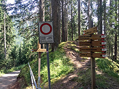
The climb starts from the main road up through Alta Badia at Picolin/Pikolein/Piccolino (1100m (or possibly at 1103m if coming from up the valley)). The climb is mostly steep on a narrow road with nice views up around Gran Jų. After a short tunnel the road turns to gravel, but there is then only 400m to reach the pass.
One could continue to the end of the road to the ski lift at Col dl’Ancona (1612m), which is very near, where you will get some views down the other side. But better to take the road taking off to the right, which is the one going down the other side. On the east side all is asphalted apart from 650m R1-2, but unfortunately at least one ramp is too bad and steep to use with a road bike, so if better go down that side and walk down this ramp!
[IT-BZ-1535]