1164m - 15.8 km (941m - 13.2 km) (St. Jean de Maurienne via Les Bottières)
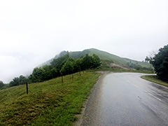
The climb up to La Toussuire (1732m) from Saint-Jean-de-Maurienne (568m) will touch a ridge slightly higher than the actual location of the Col des Trois Croix walking pass, which is located at 1490m and is easy to reach by walking 50m up from the road, but as you reach the same ridge without going off you bicycle a little higher up, there is no real need (as I did) to walk up there just to claim this pass. La Toussuire looked rather lack-lustre when I was there, but it was cold and the views up and down from there should be better in nicer weather.
There are two main variants up here (look closer on the map for some possible short-cuts where I show the shortest climbs). I climbed through Jarrier myself, which involves a little descent, so do not include that variant here and cannot say for sure which of the two climbs I show here that I would recommend, but probably the one via Les Bottières.
[FR-73-1490]