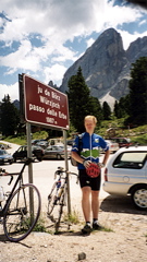
Sign 1987m
1083m - 14.4 km (Zwischenwasser/Longega via Rina/Welschellen)
1055m - 14.8 km (Picolin/Pikolein/Piccolino)
1014m - 13.4 km (Picolin/Pikolein/Piccolino via Miri road)
1427m - 27 km (Brixen/Bressanone via Lüsen/Luson/Lijun)
1629m - 30 km (Brixen/Bressanone via Passo di Éores/Kofeljoch)
1521m - 25.5 km (Villnößtal/Val di Funes via Russiskreuz)
If you come down Val Badia/Gadertal it is a good idea to climb from Picolin/Pikolein/Piccolino (1088m) and climb over a little unnamed pass down to Antermëia. There are two possible roads up here: the main one goes through S. Martin/St. Martin/S. Martino and was the one I first travelled. But you can also turn right after the bridge and climb the Miri road (see map), which I have not climbed, but it is asphalted. The eastern approaches are all regarded as hard climbs and it is steep just after Antermëia/Antermóia/Untermoi (1515m) (up to 16%).
If coming from the Pustertal/Val Pusteria, you start down in St. Lorenzen/S. Lorenzo di Sebato (806m) and after a slow rise on a busy new road with (lit) tunnels, you turn off the main road just after Zwischenwasser/Longega (1012m), which is where you would start if you had come down from the Ju de Furcia/Furkelsattel/Passo Furcia (1759m). You then climb the Rina/Welschellen road to the end of the village, where the road starts a slow descent for a while, but then climbs again to Antermëia.
If coming from the northwest you can start in Brixen/Bressanone (566m) and could go directly to the pass via a very small road going via Lüsen/Luson/Lijun. This road is a bit steep some way after Lüsen. You can also climb the Plose road via Eores/Afers and Passo di Éores/Halsl/Kofeljoch (1866m) with only a short descent to 1797m (to meet the road from Lüsen) before the last stretch to the pass.
Finally, if coming from the Bolzano/Bozen direction, you would do well to climb the Villnößtal/Val di Funes and then you turn off at the village named after the valley to climb a steep road up to Russiskreuz/Sella di Russis (1729m), but at this pass, you continue flat for some metres until you meet the road via Eores/Afers and then it is the same road to the pass. All approaches to the pass has some steep sections.
[IT-BZ-1992, BIG 710]