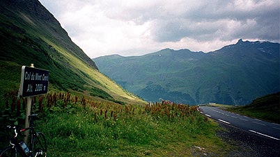
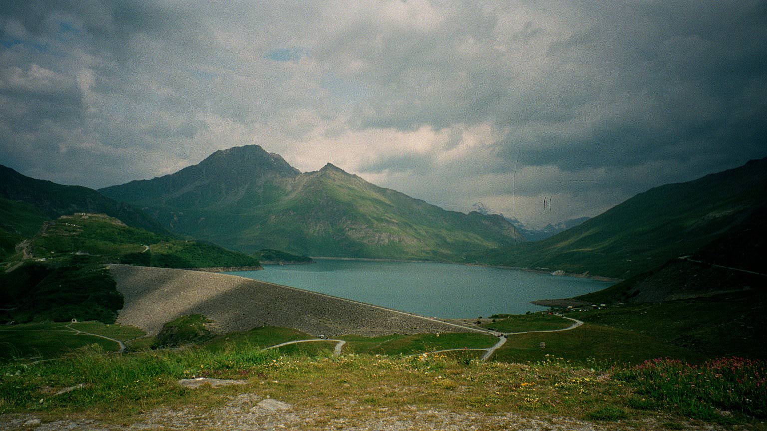
It was a nice but chilly morning and with an occassional very light drizzle. I went up the serpentines in the forest above Lanslevillard and heard the churchbells from below. The road is quite good and just above Lanslevillard you meet up with the main road coming from Lanslebourg just south of Lanslevillard (I saw both villages as I climbed the road). The climb is somewhat easy and it was not so long (640 m). Col du Mont Cenis (2081 m) seemed at first like a quiet place, but as it was saturday morning there were a lot of activities going on up there, it turned out. It seemed like it was mostly italians there as the road down to Italy was just a line of cars and motorcycles on their way up there. Around the big Lac du Mont Cenis were several running and mountainbike events going on. There was also a big market and a lot of old antique Bugatti cars and the like and plenty of motorcyclists. The road was hard to pass this morning, but I was definitely going in the right direction.
The road down to Susa was probably the nicest road to descend of all I cycled during my 14 days of cycling. It was perfectly smooth and most often with bends not sharp enough so I did not have to slow down. I could almost keep the same speed as some motorcyclists down there. An added danger was the many motorcyclists going up the road passing the cars.
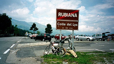
Down at Susa I passed only 10 meters from where I had been a few days earlier. Then the road was almost flat and mostly straight further down the Valle di Susa. I turned off to a village called Villàr Dora (364 m). It was hot, but still not too hot. I had a little lunch just at the start of the road up Colle del Lis (or is it Lys like it says on the sign?) – sandwhich with salami and some fruit. Then I was on my way up a nice and sweet road to Colle del Lis (1311 m), which is not high but still nearly a thousand meters climb on an average or slightly tougher pass road (but with easy sections), so do not be surprised if it takes a while to get up there.
It was nice weather and many italians go up in the hills during their long lunch brakes and the place was filled with people all around at the top. Well, yes, it was also saturday!
The road that continues at a somewhat high altitude is almost a perfect cycling route, apart from a few short stretches where the asphalt was very bad (it is so good otherwise that it becames almost dangerous when you suddenly realize there are some problems with the surface, so watch out). It is a very nice landscape and not many people live on the other side of the col, which is a bit odd, since the area is so well-exploited otherwise. One soon passes by a little village and the Col San Giovanni (1116 m) before the road descends to the next valley – the Val di Viù and the village with the same name. This village seemed to also be a very popular vacation spot for the italians. I continued down to Lanzo Torinese, where the roads from three valleys meet up. I really wished to stay at high altitude as much as possible, but there are suspiciously few roads up in the mountains here – at least there are not any high altitude crossings that I know of. I went over S. Pietro and Colle Fórcola (736 m) on a very nice and good road to Cório (it is not very easy to find the right road; I was partly lucky after making an obviously wrong entrance to the city of Lanzo and also had to ask one person).
Arriving at the crossing in Cório, I was very confused about the way to proceed, but trusted my map and went straight through the city (which looked the most unlikely of the alternatives) and might not have been the most correct, but I came out straight on a road taking me where I was heading, which was Rocca Canavese, Levone and Rivara (392 m). There simply was no road all over 400 m that could take me up north – at least not according to my Michelin and TCI maps.
I went up to Forno Canavese and to Courgné via Prascorsano (around 700 m), which must be a real col also for all that I could understand. In Courgné (414 m) there was hardly a place open and I simply bought and icecream and continued up the Valle di Locana which ends with the Colle del Nivolet pass (2612 m). It was perfectly clear to me that I would not be able to get over this col that day, but I thought I should go a bit up the valley to be gaining some distance and as there was still some time before the dark would arrive. I went up the valley but it soon started to rain. I passed by Locana, but stopped at a shop in Rosone, but apparently there were no rooms in that little village and the lady told me to hurry on up to Noasca if I wanted to get there before 19, when the shops close.
I went to Noasca and as I approached, the road indeed became steeper and tougher and worse. But I was there in time and asked at the main restaurant, auberge whether they had a room and they had. The place was not good (but not expensive either, 22 euro), and I had some confusion with the romanian girl working there over the dinner, but it all worked out in the end. It started to rain and storm outside, so I could not even get out. One hears a constant thundering sound from the falling river all day and night there.
Day1 – Day 2 – Day 3 – Day 4 – Day 5 – Day 6 – Day 7 – Day 8 – Day 9 – Day 10 – Day 11 – Day 12 – Day 13 – Day 14 – Day 15