1314m - 29.7 km (Rochetaillée/Bourg d’Oisans)
1439m - 19.9 km (St-Étienne-de-Cuines)
[FR-73-1924]
|
Height | Climbing height - length |
| 1924m | 1234m - 22.6 km (Bge du Verney) 1314m - 29.7 km (Rochetaillée/Bourg d’Oisans) 1439m - 19.9 km (St-Étienne-de-Cuines) |
|
| Difficulty | Beauty | |
| 4 (5) | 3-4 (5) | |
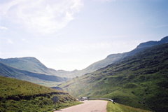
| How to get there | The north side from Saint-Étienne-de-Cuines (485m) is quite steep and hard with gradients up to 15% and can be continued after a little dip to the nearby Col de la Croix de Fer (2065m). The southern climb starts not far from the village of Bourg d’Oisans at Rochetaillée (711m). One could also start a bit higher up on this side if coming from the Alpe d’Huez road down to the Barrage du Verney (791m). The southern climb is a bit irregular but not quite as difficult as the northern side. (For a profile on the north side see here: Glandon/Croix de Fer.) | |
| Other comments | See Col de la Croix de Fer for more information. You could also visit the not far away Col du Sabot (2100m), which can be climbed from the Barrage du Verney. From Col du Sabot you will see Col du Glandon in front of you. There is a bar just below the pass at the crossroad with the Croix de Fer road. [FR-73-1924] |
|
| Map |
||