1000m - 16.4 km (Rochetaillée/Bourg d’Oisans)
[FR-38-1700a]
|
Height | Climbing height - length |
| 1706m | 901m - 9.3 km (Lac du Verney) 1000m - 16.4 km (Rochetaillée/Bourg d’Oisans) |
|
| Difficulty | Beauty | |
| 4 (5) | 4 (5) | |
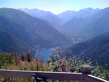
| How to get there | The climb starts by Lac du Verney (805m) in the Isère valley on the south side of the climb to Col du Glandon (1924m) and Col de la Croix de Fer (2065m). If you have visited Col du Sabot (2100m) you have taken the same road as a start up to Vaujany (1200m) and start on this specific climb just below the village at a sign saying ‘Route de Bois de Bessay’. The road is consistently steep up from the dam at ca. 9%. | |
| Other comments | The asphalt ends soon after reaching the top. The location of the passage up here is properly at the end of the asphalt where you can see the signs for the path leading down both sides steeply. There is no water above Vaujany and it can be quite hot here in the Summer. There is a nice viewpoint place at the top with signs explaining which mountain tops you see in the different directions. The road up through the forest is not used by many, but is a decently good road. This pass is often confused with the locality Le Collet (de Vaujany) (1405m) (even by “locals”) which is above Vaujany on the way to Col du Sabot. [FR-38-1700a] |
|
| Map |
||