992m - 11.2 km (992m - 14 km) (Samoëns via Chantemerle)
1016m - 11.7 km (1015m - 14.5 km) (Villard)
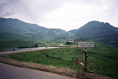
706m - 11.1 km (672m - 8.3 km) (Morzine)
The classic climb starts in Samoëns (698m) where you could follow the main road to the top at Chalet du Col de Joux Plane (1690m) or you could turn off on the road via Chantemerle that is a little shorter and thus steeper still. One could also start a bit before coming to Samoëns and take off an alternative road via Le Villard (674m) (there is a more obvious turn-off for Le Villard earlier, but it is a little longer, so I only show this more obscure alternative which is the shortest on the map below). One could possibly also go via Mathonex (885m), which is slightly longer or start the climb on the ast side of the Samoëns village, but I only list the two shortest/steepest climbs and the classic one here.
As Col de Joux Plane (1712m) is on a gravel track and is never crossed while staying on asphalt, this is not really a pass as the pass sign (saying 1700m) on the road suggests. People commonly refer to the climb as a pass and so it is, but only because the road crosses another pass on the way to Morzine – the Col du Ranfolly.
The northern climb from Morzine (984m) is a bit shorter and less nice. Both climbs are quite hard!
[FR-74-1655, BIG 274]