659m - 12.5 km (720m - 13.3 km - Albergo Verenetta) (Ponte Roana)
|
Height | Climbing height - length |
| 1593m (1654m, Albergo Verenetta) | 1282m - 21.6 km (1343m - 22.5 km - Albergo Verentta) (Pedescala) 659m - 12.5 km (720m - 13.3 km - Albergo Verenetta) (Ponte Roana) |
|
| Difficulty | Beauty | |
| 3-4 (5) (Southwest); 3 (5) (Southeast) | 2-3 (5) | |
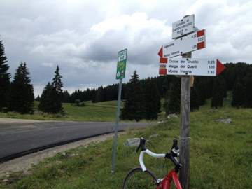
| How to get there | The longest climb starts down in Val d’Astico at Pedescala (311m). This climb takes you through a set of magnificient hairpins to Rotzo, but when you take off the main road up toward Bocchetta Campolongo (1534m), you enter the woods and will so remain most of the time. From this side there is a narrower road up than if coming from Asiago and Ponte Roana (934m). For some reason I went back the same bigger road down when I was there (maybe because it might be a little faster), but believe they both will be fine. It is steep in short sections when you get up to Campolongo, but flatter here and there. It seems logical to continue up to Albergo Verenetta (1654m) when you are here as it is the highest asphalted point in this area. | |
| Other comments | The location of Bocchetta Campolongo as a pass looks a bit odd, but correct in some sense (it seemed as if there had been a sign here as two empty sign poles stand at the top (maybe someone has stolen the sign or it was taken down with the recent improvement of the road). The road is in very good shape (particularly higher up). The asphalt road continues down the obvious pass at Casara di Campovecchio (though without any real pass name). The road eventually runs out of asphalt as it will go up and down and could eventually take you to Passo di Vezzena (1414m). (There is another pass (also unnamed) not so far from the asphalt road ahead at Malga Mandrielle, but the gravel road there looks a bit rough and it is quite uninteresting anyway for road cyclists, so let us forget about this.) At Verenetta you only see the ski slopes going up to the mountain here. Still no views back down, so the only nice part of this climb is before taking off the main road. |
|
| Map |
||