Sign 1547
[FR-04-1540]
|
Height | Climbing height - length |
| 1543m Sign 1547 |
628m - 7.6 km (Saint-André-les-Alpes) | |
| Difficulty | Beauty | |
| 3 (5) | 4 (5) | |
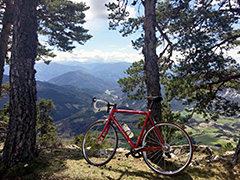
| How to get there | This is a climb at the the start of the road up to Col d’Allos/Col de Valgelaye (2247m) from the south. At Saint-André-les-Alpes (Chemin des Vertus) (915m) on a small road above the train station this little known climb starts and it soon becomes very steep. It is a fairly hard climb for the length (just 628 height metres) with 8.3% steepness. The views improves higher up and the last part is really easy and the very last part is flat. Just as you arrive before the parking there is a small path that takes you up in 50m to the actual pass with very nice views in good weather. | |
| Other comments | This is a nice rural area just southwest of the very big passes in the French Alps with many passes to climb. [FR-04-1540] |
|
| Map |
||