1166m - 11.1 km (Montreux-Chamby)
1137m - 10.5 km (Montreux-Sollard)
1111m - 12.3 km (Veytaux)
If you come from Châtel Saint-Denis you can start the climb in Brent (566m), showing the shortest way on the map, which starts with a road barred to all but walkers and perhaps cyclists just after the Brent bridge (I used the bigger later road myself up to Chamby as I was not aware of alternatives). See also the two alternative road variants on the way to Les Avants before the finaly steep climb to the pass.
This climb is not necessarily horribly difficult, but let us continue with the shortest road variant from Montreux (375m) and this one will make the toughest climbers in the world wonder if climbing up roads like this is maybe not for them. The very start I do not know, but believe there is no problem, but Côte de Pallens with cobbelstones and 19-20% and you have to get off the bike here shortly at the top section to pass the traffic bars. Then easy again, but soon there are some close to 20% ramps again, then easy, but if you follow the road you will soon come to a 34% ramp (might be only ca. 30%, but the sign says more) and this is likely the show-stopper for most. However, thereafter it is all fine again until the famously hard last part.
I also note an even shorter way up and it might be preferable as it avoids the 34% ramp. This uses the Chemin de Sollard road instead, which also looks quite steep and you will on this shortest climb have 10.9% on average for 10.5 km. This variant could have been even shorter (10.05 km), but pavement is missing for 170m (Chemin du Culet) and there is another alternative with 9.94 km where one needs to walk 225m (Chemin des Bignières with asphalt road 30% until it crosses the main Route de Chamby on the way to the Sollard road). But of course you can just take the main road up too.
From Veytaux (401m) it should be a fairly good climb too (easier if you go via Caux (2 km longer, 14.3 km)). From Villeneuve via Sonchaux and Caux it is 20.2 km.
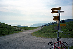
[CH-VD-1512, BIG 543]