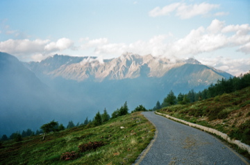
1616m - 18.78 km - 8.6% (Mazzo di Valtellina)
1608m - 18.15 km - 8.9% (Mazzo di Valtellina direct)
1571m - 18.42 km - 8.6% (Grosotto)
1502m - 20.29 km - 7.4% (Grosio)
1502m - 18.84 km - 8.0% (Grosio direct)
1444m - 20.50 km - 7.1% (Ponte di Grosio)
1443m - 22.37 km - 6.5% (Edolo)
1443m - 18.60 km - 7.8% (Edolo - Vecchia Mulatteria)
1238m - 17.85 km - 7.0% (Monno/Ponte dei Pellegrini)
1238m - 14.09 km - 8.8% (Monno - Vecchia Mulatteria)
This pass is a cul-de-sac continuation 6.74 km (and 306 height metres) away from the famous Passo della Foppa/Pas de la Foppa (Passo del Mortirolo) (1855m). After a minor descent from the Foppa pass to the turn-off for Monno (1824m) one follows a road that is rather flat at first. The description is otherwise similar to the Foppa/Mortirolo climb.
The classic climb from the north starts from the east of Tirano in Mazzo di Valtellina (545m). Here (too) along the roadside a statue to the memory of Marco Pantani has been raised. From the centre of Mazzo (553m) the steepest climb on average is found by taking a short-cut to meet the normal road higher up.
An interesting northern climb starts just before the village of Tovo S. Agata (524m) if coming from Tirano (there are no sign posts). As soon as you reach the woods the road becomes good and steep. There is nowadays a sign higher up to point out where to take off the road to go to Mortirolo. There the road is flat for a short while and then comes some very steep concrete ramps up to above 20%. When I went up here before they fully paved the road over to the Mortirolo road (for a stage in Giro d’Italia not so long ago) there were no signs and I missed the turn-off and went up on a grassy track with concrete ramps up to 32% to eventually meet the Foppa-Trivigno road (which I only saw when I was metres away from it). This approach is the hardest (very irregular), but fun.
Further toward Passo dello Stelvio one could start the climb also from Grosotto (590m) and from Grosio (659m) with two variants. Finally one could start just east of Ponte di Grosio (717m), which is the easiest climb from the north (and perhaps the best road to descend to the north).
The southern climb starts in Edolo (687m) or if coming from Passo del Tonale (1882m) or Passo di Gavia (2619m), you turn off to Monno at Ponte dei Pellegrini (892m). It is a very hard climb on any approach, but normal road from Monno is easiest (only last bit is steep). I did in 2018 take the direct road through Monno (had to walk part of the last ramp) and then at the first bend on the main road I went straight ahead on the Vecchia Mulatteria to meet the main road just before the last steep section there. This variant is at least as hard as any of the others and perhaps least known of all the climbs up here!
[IT-BS-2093]