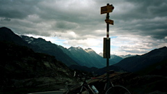
homePasso del San Bernardino/St. Bernhardinpass/Pass dal S. Bernardin/Col du St-Bernardin
Passo del San Bernardino/St. Bernhardinpass/Pass dal S. Bernardin/Col du St-Bernardin Height Climbing height - length
2067m
Sign 2066m
1646m - 31.1 km (Lostallo)
1827m - 48.6 km (Arbedo-Castione)
455m - 8 km (Hinterrhein)
609m - 19.6 km (Splügen)
1464m - 45.7 km (Thusis)
Difficulty Beauty
South 4 (5); North 1-2 (5) 4 (5)
How to get there

This is a very long (50 km) and sometimes hard climb from the south. It starts flat from Arbedo-Castione (240m) and starts to take off at Lostallo (421m) 17.5 km later. It is very steep around Mesocco (790m) and then actually drops a little to the village of San Bernardino. (There is a small pass before here on a side road: Forcola (1618m).) From there it is an unusual and interesting climb to the pass.

The north side is only a shorter climb from Hinterrhein (1612m) which you reach on a small road from Splügen (1458m). The road all the way from Thusis (720m) does include some really nice stretches through gorges before Splügen is reached. The big road that goes through a tunnel (opened 1967) at Hinterhein to San Bernardino is not allowed for bicyclists.

Other comments The undulating road on the south side above the tunnel gives you headache in trying to figure out where it may be leading. You will tend to believe that you are close to the pass height several times before you actually are close (like on several other mountain passes). There are good views from the top. There are bars at Mesocco and San Bernardino along the way. This pass separates the Italian Switzerland from the Germanic/Rumantsch Switzerland on the northern side. If you got time and the weather is good, you should really consider the climb over the Lai da Vons (2073m) (there is only ca. 2 km normal gravel road and only 20m is steep on this stretch).
[CH-GR-2065a, BIG 590]
Map