[FR-04-2639]
|
Height | Climbing height - length |
| 2649m |
1409m - 20.3 km (Jausiers) |
|
| Difficulty | Beauty | |
| 3 (5) | 3 (5) | |
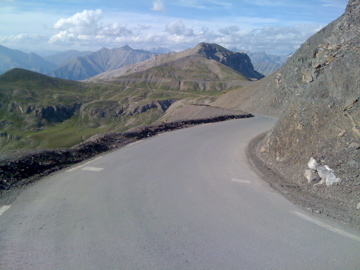
| How to get there | From the Ubaye valley to the north one starts the climb in Jausiers (1219m). From there it is a rather regular and moderately steep pass road to the top. From the south-west you come from down at Bayasse (1783m) on the road to Col de la Cayolle (2326m) by a jeep track road (R1-2) which is only partly cyclable with a road bike and it is very prone to mountain slides. You could rather easily get from Col de la Moutière (2444m) and then up the Vallon de Restefond via this pass to the road that goes to Col de la Bonette (Cime de la Bonette) (2715m). | |
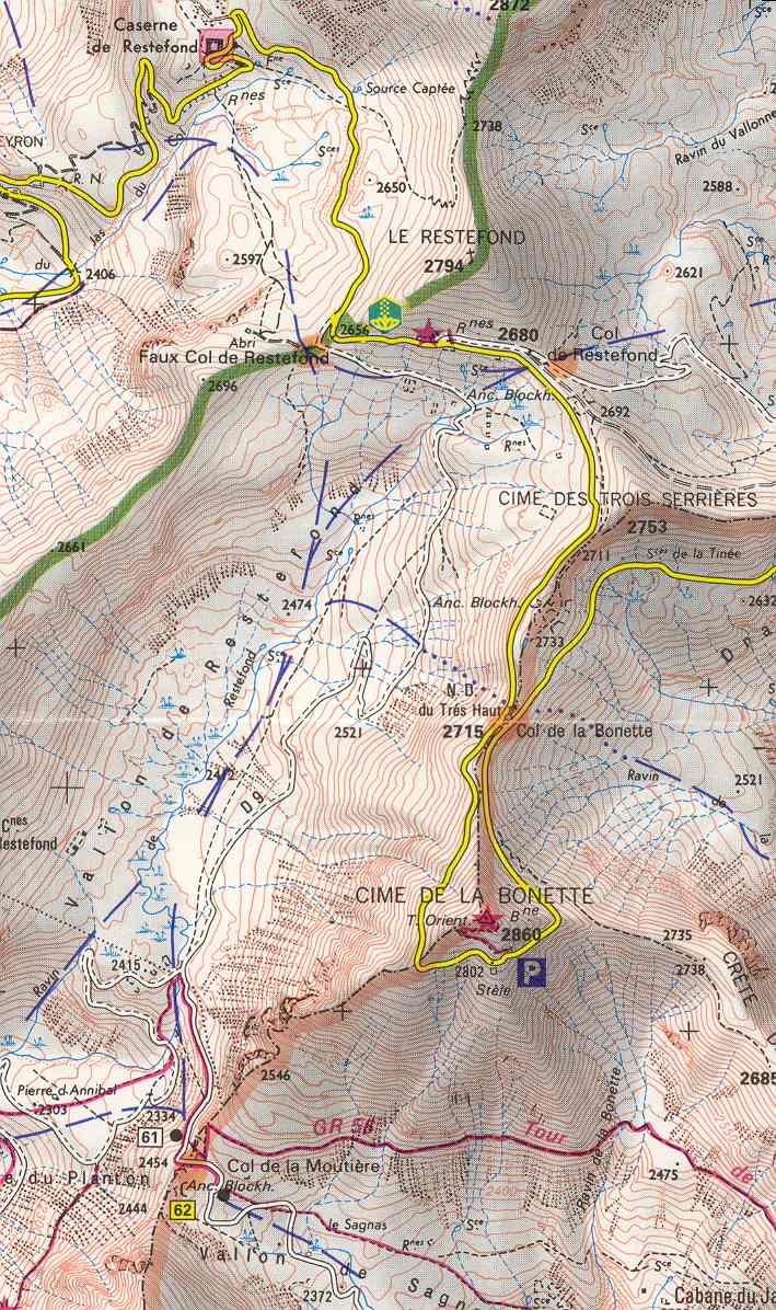
| Other comments | This pass is strictly speaking not on the road to Col de la Bonette, but most would claim to have visited it even though they do not bother to go the 50 metres in on the gravel road below. I think it is proper (in this case) to say you have been at the pass even if you only continue up to the next pass on the paved road as you here cross the relevant ridge on the asphalt road and the officially recognised passage is nearby on a lower crossing. Thus it is included in the list of paved passes (also since I list one-sided pass climbs here). See the IGN map (at centcols.org). (The nearby Col de Restefond (2680m), requires that one cross another ridge in the mountains and is a bit further away from the road, so this is not counted as on the Bonette road.) [FR-04-2639] |
|
| Map |
||