Sign 2024m
502m - 6.6 km (Sacklhütte); 1079m - 21.1 km (Innerkrems); 1599m - 30.7 km (Kremsbrücke)
[AT-2-2020]
|
Height | Climbing height - length |
| 2029m Sign 2024m |
973m - 14.1 km (Ebene-Reichenau); 925m - 12.3 km (Unter-Winkl) 502m - 6.6 km (Sacklhütte); 1079m - 21.1 km (Innerkrems); 1599m - 30.7 km (Kremsbrücke) |
|
| Difficulty | Beauty | |
| South 3 (5); North 2 (5) (Sacklhütte) | 4 (5) | |
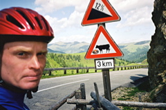
| How to get there | A good road (Nockalmstrasse) goes from nice little village of Ebene-Reichenau (1057m) to the pass on the south side. If you come down the steep Turracherhöhe (1794m) you start the climb at Unter-Winkl (1104m). It is not too difficult with a maximum steepness around 12%. From the west side you first have to climb the harder Eisentalhöhe (2049m) and then descend to Sacklhütte (1527m) before a short climb which is also up to 12% until the pass. | |
| Other comments | The pass road is called the Nockalmstrasse and is a touristic road through a national park. It is quite nice in this area, especially up at Schiestelscharte/Glockenhütte where you pass a nice little lake and in the area between the two high points of the road. There are bars at both heights and at Sacklhütte in between. Eisenthalalm/Eisentalhöhe (2049m) seems like a pass itself, but is not usually regarded as such, but is included in the list here as there are grounds for arguing that it is indeed a pass. (Eisentalhöhe is really the mountaintop which you come near at the highest point, but this is also a pass.) This is the most eastern paved pass in the Alps above 2000 metres, even though the Alps continues for quite some distance eastwards from here (and with really high mountains too). [AT-2-2020] |
|
| Map |
||