946m - 13.3 km (Zwischenwasser/Longega); 1152m - 22.6 km (St. Lorenzen/S. Lorenzo di Sebato)
|
Height | Climbing height - length |
| 1862m | 924m - 12.8 km (Picolin/Pikolein/Piccolino); 883m - 12 km (Picolin/Pikolein/Piccolino via Miri road) 946m - 13.3 km (Zwischenwasser/Longega); 1152m - 22.6 km (St. Lorenzen/S. Lorenzo di Sebato) |
|
| Difficulty | Beauty | |
| 3-4 (5) | 3 (5) | |
| How to get there | If you come down Val Badia/Gadertal it is a good idea to climb from Picolin/Pikolein/Piccolino (1088m) and climb over a little unnamed pass down to Antermëia. There are two possible roads up here: the main one goes through S. Martin/St. Martin/S. Martino and was the one I first travelled. But you can also turn right after the bridge and climb the Miri road (see map), which I do not know, but it seems like it is asphalted. The eastern approaches are all regarded as hard climbs and it is steep just after Antermëia/Antermóia/Untermoi (1515m) (up to 16%). If coming from the Pustertal/Val Pusteria, you start down in St. Lorenzen/S. Lorenzo di Sebato (806m) and after a slow rise on a busy new road with (lit) tunnels, you turn off the main road just after Zwischenwasser/Longega (1012m), which is where you would start if you had come down from the Furkelpass/Passo Furcia/Ju de Furcia (1759m). You then climb the Rina/Welschellen road to the end of the village, where the road starts a slow descent for a while, but then climbs again to Antermëia. | |
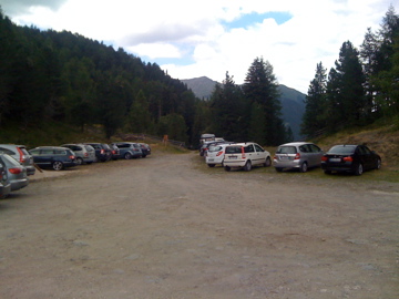
| Other comments | The name means “parking place of the Börz pass area”. Tabacco 07 marks it as a pass (which it is) but states only the name given here. At the pass one could (and should) continue up to Jù de Börz/Würzjoch/Passo delle Erbe (1993m), but one could also cycle down a gravel road at the pass. However, it will turn only into a path lower down and it might even be difficult to walk down to the Lüsen road (I have not tried it). It is much nicer on the other side of the Würzjoch! (Photo from Würzjoch.) |
|
| Map |
||