1582m - 22.68 km - 7.0% (Döllach via Apriach)
1716m - 36.78 km - 4.7% (Winklern via Heiligenblut)
1449m - 17.84 km - 8.1% (Pockhorn/Rojach)
1915m - 33.13 km - 5.8% (Bruck/Krössenbach)
1855m - 26.14 km - 7.1% (Fusch)
1517m - 19.29 km - 7.9% (Toll station)
242m - 4.11 km - 5.9% (Fuscher Lacke)
1673m - 27.07 km - 6.2% (Fuscher-Törl 2 fr. Bruck/Krössenbach)
1613m - 20.10 km - 8.1% (Fuscher-Törl 2 fr. Fusch)
1275m - 13.23 km - 9.7% (Fuscher-Törl 2 fr. Toll station)
The Großglockner road is a fantastic and beautiful road that was built in the 1930s with the expressed purpose of being a beautiful tourist road and they indeed succeded with this. The approach from the south starts at Winklern (934m to Trattner 882m) not far from Lienz and the Lienzer Dolomiten. The real climbing on the main road only starts at Pockhorn/Rojach (1107m), from where it is somewhat steep. You pass by the idyllic Heiligenblut (1291m) village. Soon thereafter at Guttal (1858m), which you descend to from Kasereck (1910m), a scenic cul-de-sac road (8.5 km) goes to Franz-Josefs-Höhe (2369m) (or 2419m). Instead of taking the main road, the road via Apriach from Großkirchheim/Döllach (1006m) is nicer and actually shorter. The main road continues up to the pass, which is at a tunnel.
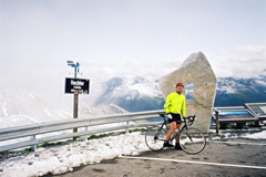
From the north you start in the area of Zell am See at Bruck and Krössenbach (755m). First after Fusch (815m) or later after the toll station (1153m) the real climb begins. It is quite steep on this side and it is one of the hardest passes in the Alps with this height. The scenery is splendid all the time and the road is fine and wide. At Fuscher-Törl (2402m) a cobblestoned (“setts” really) cul-de-sac road (1.75 km) goes to Edelweißspitze (2572m) from where the views should be the best in the area (bad weather on my visit). From the Fuscher-Törl 2 (viewpoint) (2428m) the road runs around the Törlkopf and descends to Fuscher Lacke (2262m) before it starts climbing again first through the short Mittertörl tunnel (pass above (2375m) on an ancient path) and then up to the Hochtor tunnel.
[AT-2-2504a, BIG 625]